
- Start >
- Rivers >
- Waterlevel >
- Inn >
- Rottersdorf >
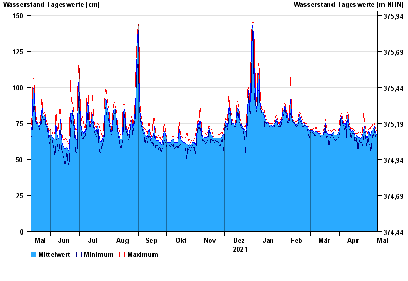
- Chart of year

Chart of year Rottersdorf / Vils
Waterlevel from 11.05.2021 to 10.05.2022
- 03.06.2013 Wasserstand: 280 cm
- 21.02.1999 Wasserstand: 255 cm
- 04.08.1991 Wasserstand: 252 cm
- 31.03.2000 Wasserstand: 226 cm
- 14.04.1994 Wasserstand: 226 cm
| Date | Mean value [cm] | Maximum [cm] | Minimum [cm] |
|---|---|---|---|
| 10.05.2022 | 67 | 70 | 65 |
| 09.05.2022 | 69 | 72 | 66 |
| 08.05.2022 | 73 | 75 | 71 |
| 07.05.2022 | 72 | 76 | 66 |
| 06.05.2022 | 71 | 75 | 68 |
| 05.05.2022 | 70 | 73 | 64 |
| 04.05.2022 | 68 | 73 | 55 |
© Bayerisches Landesamt für Umwelt 2024