
- Start >
- Rivers >
- Waterlevel >
- Inn >
- Rosenheim >
- Chart of year

Chart of year Rosenheim / Hammerbach
Waterlevel from 06.10.2020 to 05.10.2021
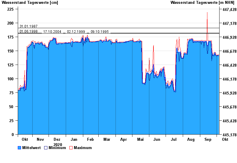
- 31.01.1987 Wasserstand: 191 cm
- 01.06.1998 Wasserstand: 182 cm
- 17.10.2004 Wasserstand: 181 cm
- 02.12.1999 Wasserstand: 181 cm
- 09.10.1995 Wasserstand: 181 cm
| Date | Mean value [cm] | Maximum [cm] | Minimum [cm] |
|---|---|---|---|
| 05.10.2021 | 142 | 143 | 141 |
| 04.10.2021 | 142 | 143 | 141 |
| 03.10.2021 | 142 | 143 | 142 |
| 02.10.2021 | 142 | 142 | 141 |
| 01.10.2021 | 141 | 142 | 141 |
| 30.09.2021 | 142 | 143 | 141 |
| 29.09.2021 | 143 | 147 | 142 |
© Bayerisches Landesamt für Umwelt 2024