
- Start >
- Rivers >
- Waterlevel >
- Inn >
- Passau Ingling >
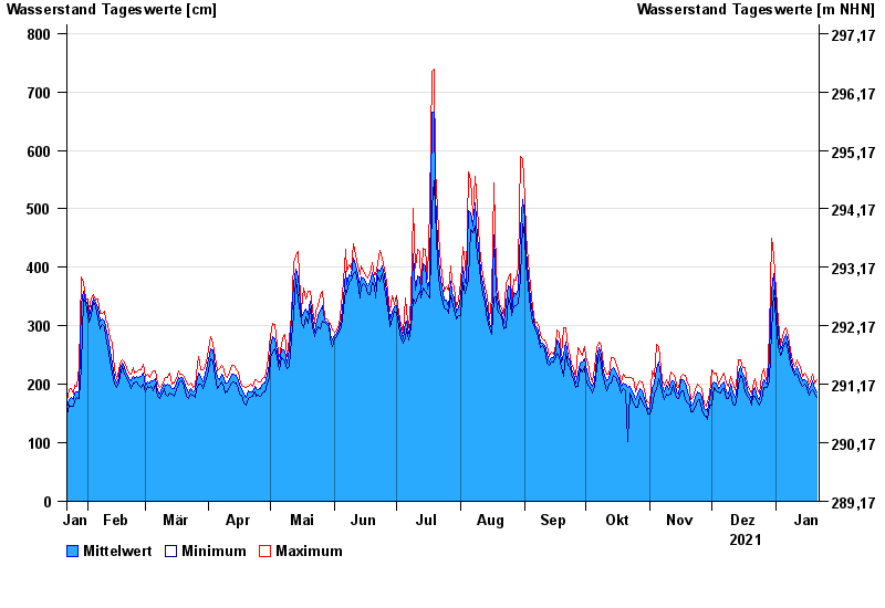
- Chart of year

Chart of year Passau Ingling / Inn
Waterlevel from 22.01.2021 to 21.01.2022
- 03.06.2013 Wasserstand: 1159 cm
- 13.08.2002 Wasserstand: 973 cm
- 08.08.1985 Wasserstand: 888 cm
- 21.07.1981 Wasserstand: 876 cm
- 03.08.1991 Wasserstand: 864 cm
| Date | Mean value [cm] | Maximum [cm] | Minimum [cm] |
|---|---|---|---|
| 21.01.2022 | 187 | 208 | 178 |
| 20.01.2022 | 192 | 203 | 184 |
| 19.01.2022 | 206 | 217 | 191 |
| 18.01.2022 | 201 | 210 | 189 |
| 17.01.2022 | 191 | 200 | 182 |
| 16.01.2022 | 205 | 214 | 192 |
| 15.01.2022 | 208 | 219 | 200 |
© Bayerisches Landesamt für Umwelt 2024