
- Start >
- Rivers >
- Waterlevel >
- Inn >
- Passau Ingling >
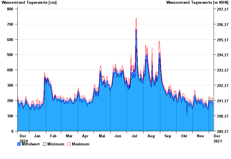
- Chart of year

Chart of year Passau Ingling / Inn
Waterlevel from 10.12.2020 to 09.12.2021
- 03.06.2013 Wasserstand: 1159 cm
- 13.08.2002 Wasserstand: 973 cm
- 08.08.1985 Wasserstand: 888 cm
- 21.07.1981 Wasserstand: 876 cm
- 03.08.1991 Wasserstand: 864 cm
| Date | Mean value [cm] | Maximum [cm] | Minimum [cm] |
|---|---|---|---|
| 09.12.2021 | 184 | 197 | 176 |
| 08.12.2021 | 188 | 202 | 175 |
| 07.12.2021 | 204 | 219 | 192 |
| 06.12.2021 | 200 | 211 | 190 |
| 05.12.2021 | 197 | 208 | 185 |
| 04.12.2021 | 193 | 200 | 187 |
| 03.12.2021 | 203 | 220 | 189 |
© Bayerisches Landesamt für Umwelt 2024