
- Start >
- Rivers >
- Waterlevel >
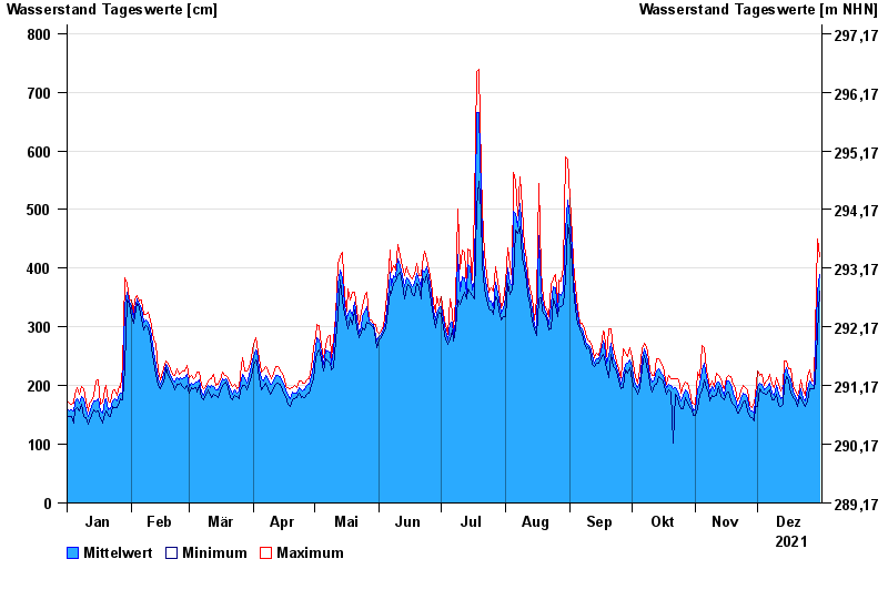
- Inn >
- Passau Ingling >
- Chart of year

Chart of year Passau Ingling / Inn
Waterlevel from 01.01.2021 to 31.12.2021
- 03.06.2013 Wasserstand: 1159 cm
- 13.08.2002 Wasserstand: 973 cm
- 08.08.1985 Wasserstand: 888 cm
- 21.07.1981 Wasserstand: 876 cm
- 03.08.1991 Wasserstand: 864 cm
| Date | Mean value [cm] | Maximum [cm] | Minimum [cm] |
|---|---|---|---|
| 31.12.2021 | 390 | 420 | 361 |
| 30.12.2021 | 361 | 449 | 289 |
| 29.12.2021 | 248 | 289 | 206 |
| 28.12.2021 | 200 | 208 | 194 |
| 27.12.2021 | 203 | 208 | 195 |
| 26.12.2021 | 208 | 226 | 195 |
| 25.12.2021 | 194 | 215 | 173 |
© Bayerisches Landesamt für Umwelt 2024