
- Start >
- Rivers >
- Waterlevel >
- Inn >
- Passau Ingling >
- Chart of year

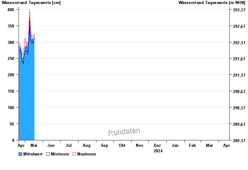
Chart of year Passau Ingling / Inn
Waterlevel from 20.04.2024 to 19.04.2025
- Hochwassergefahrenfläche HQ100 1140 cm
| Date | Mean value [cm] | Maximum [cm] | Minimum [cm] |
|---|---|---|---|
| 03.05.2024 | 277 | 279 | 275 |
| 02.05.2024 | 281 | 294 | 274 |
| 01.05.2024 | 288 | 315 | 271 |
| 30.04.2024 | 278 | 298 | 261 |
| 29.04.2024 | 267 | 279 | 258 |
| 28.04.2024 | 255 | 280 | 232 |
| 27.04.2024 | 250 | 261 | 242 |
© Bayerisches Landesamt für Umwelt 2024