
- Start >
- Rivers >
- Waterlevel >
- Inn >
- Passau Ingling >
- Chart of month

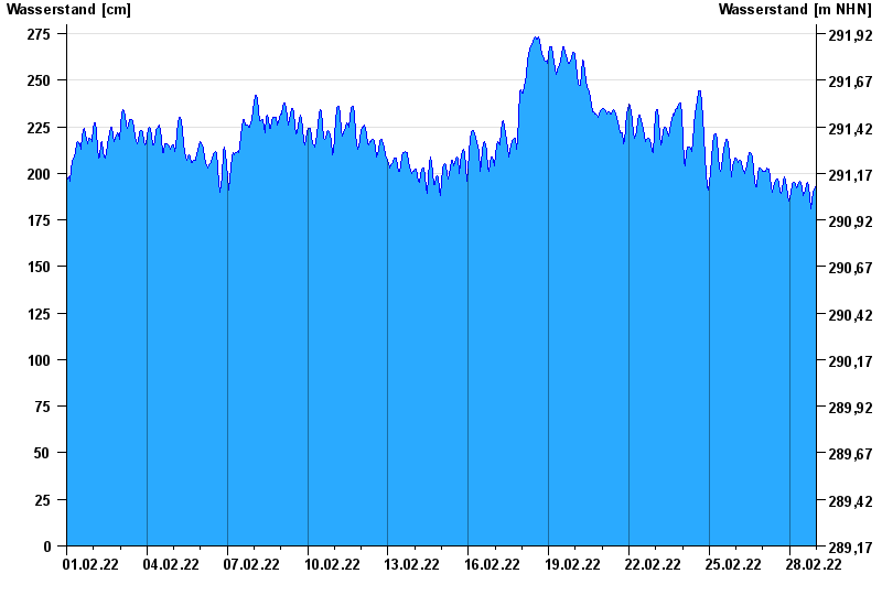
Chart of month Passau Ingling / Inn
Waterlevel from 01.02.2022 to 28.02.2022
- Hochwassergefahrenfläche HQ100 1140 cm
| Date | Waterlevel [cm] |
|---|---|
| 28.02.2022 23:45 | 193 |
| 28.02.2022 23:30 | 193 |
| 28.02.2022 23:15 | 193 |
| 28.02.2022 23:00 | 193 |
| 28.02.2022 22:45 | 193 |
| 28.02.2022 22:30 | 191 |
| 28.02.2022 22:15 | 190 |
© Bayerisches Landesamt für Umwelt 2024