
- Start >
- Rivers >
- Waterlevel >
- Inn >
- Oberach >
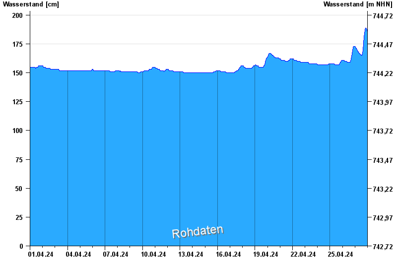
- Chart of month

Chart of month Oberach / Weißach
Waterlevel from 01.04.2024 to 27.04.2024
- Hochwassergefahrenfläche HQ100 320 cm
| Date | Waterlevel [cm] |
|---|---|
| 27.04.2024 16:30 | 174 |
| 27.04.2024 16:15 | 172 |
| 27.04.2024 16:00 | 171 |
| 27.04.2024 15:45 | 170 |
| 27.04.2024 15:30 | 169 |
| 27.04.2024 15:15 | 168 |
| 27.04.2024 15:00 | 167 |
© Bayerisches Landesamt für Umwelt 2024