
- Start >
- Rivers >
- Waterlevel >
- Inn >
- Neustift >
- Chart of year

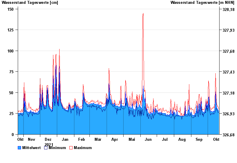
Chart of year Neustift / Wolfach
Waterlevel from 22.10.2021 to 21.10.2022
- 22.02.1970 Wasserstand: 301 cm
- 13.01.2011 Wasserstand: 293 cm
- 12.02.2005 Wasserstand: 290 cm
- 20.02.1999 Wasserstand: 276 cm
- 31.01.1982 Wasserstand: 272 cm
| Date | Mean value [cm] | Maximum [cm] | Minimum [cm] |
|---|---|---|---|
| 21.10.2022 | 28 | 30 | 27 |
| 20.10.2022 | 29 | 33 | 26 |
| 19.10.2022 | 30 | 33 | 27 |
| 18.10.2022 | 31 | 35 | 29 |
| 17.10.2022 | 32 | 35 | 29 |
| 16.10.2022 | 40 | 51 | 32 |
| 15.10.2022 | 51 | 73 | 28 |
© Bayerisches Landesamt für Umwelt 2024