
- Start >
- Rivers >
- Waterlevel >
- Inn >
- München >
- Chart of year

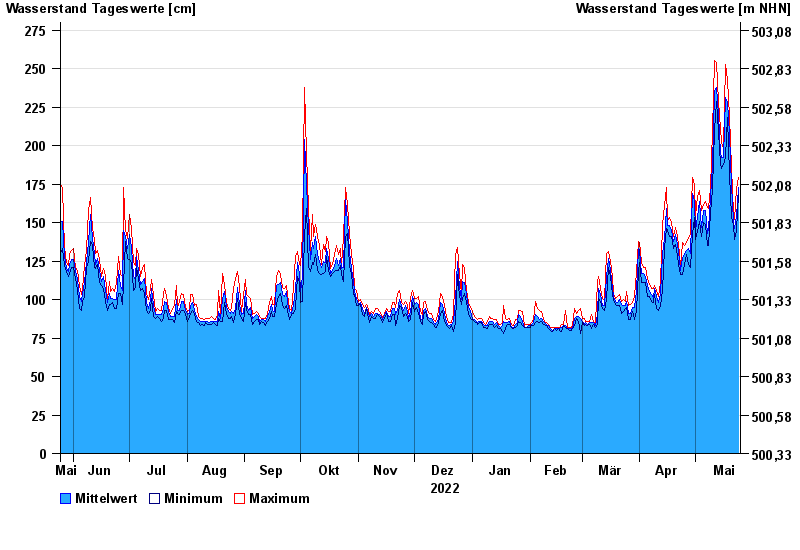
Chart of year München / Isar
Waterlevel from 25.05.2022 to 24.05.2023
- 24.08.2005 Wasserstand: 542 cm
- 22.05.1999 Wasserstand: 469 cm
- 03.06.2013 Wasserstand: 432 cm
- 20.07.1981 Wasserstand: 424 cm
- 18.06.1979 Wasserstand: 424 cm
| Date | Mean value [cm] | Maximum [cm] | Minimum [cm] |
|---|---|---|---|
| 24.05.2023 | 173 | 179 | 168 |
| 23.05.2023 | 154 | 172 | 145 |
| 22.05.2023 | 146 | 152 | 139 |
| 21.05.2023 | 151 | 156 | 148 |
| 20.05.2023 | 174 | 186 | 154 |
| 19.05.2023 | 207 | 219 | 181 |
| 18.05.2023 | 228 | 242 | 218 |
© Bayerisches Landesamt für Umwelt 2024