
- Start >
- Rivers >
- Waterlevel >
- Inn >
- Mühldorf >
- Chart of year

Chart of year Mühldorf / Inn
Waterlevel from 19.05.2022 to 18.05.2023
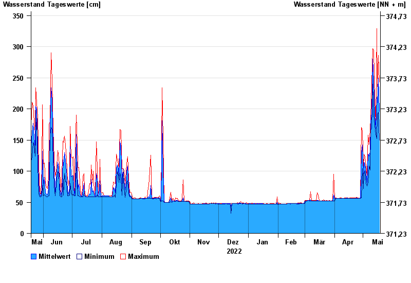
| Date | Mean value [cm] | Maximum [cm] | Minimum [cm] |
|---|---|---|---|
| 18.05.2023 | 196 | 243 | 150 |
| 17.05.2023 | 250 | 286 | 194 |
| 16.05.2023 | 210 | 236 | 191 |
| 15.05.2023 | 218 | 329 | 152 |
| 14.05.2023 | 169 | 179 | 159 |
| 13.05.2023 | 190 | 213 | 174 |
| 12.05.2023 | 245 | 294 | 190 |
© Bayerisches Landesamt für Umwelt 2024