
- Start >
- Rivers >
- Waterlevel >
- Inn >
- Mühldorf >
- Chart of year

Chart of year Mühldorf / Inn
Waterlevel from 19.05.2020 to 18.05.2021
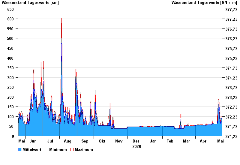
| Date | Mean value [cm] | Maximum [cm] | Minimum [cm] |
|---|---|---|---|
| 18.05.2021 | 90 | 102 | 73 |
| 17.05.2021 | 76 | 100 | 61 |
| 16.05.2021 | 61 | 63 | 61 |
| 15.05.2021 | 86 | 102 | 63 |
| 14.05.2021 | 112 | 138 | 94 |
| 13.05.2021 | 164 | 184 | 138 |
| 12.05.2021 | 165 | 190 | 129 |
© Bayerisches Landesamt für Umwelt 2024