
- Start >
- Rivers >
- Waterlevel >
- Inn >
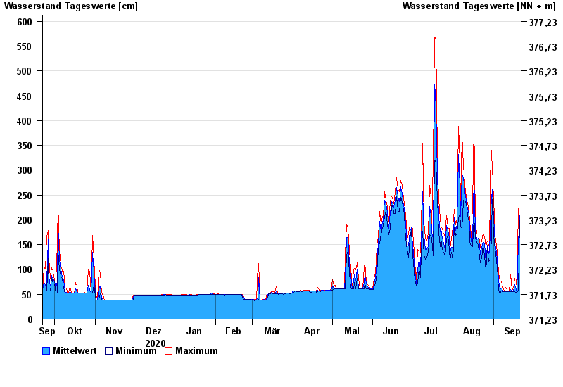
- Mühldorf >
- Chart of year

Chart of year Mühldorf / Inn
Waterlevel from 22.09.2020 to 21.09.2021
- 24.08.2005 Wasserstand: 799 cm
- 07.08.1985 Wasserstand: 766 cm
- 03.06.2013 Wasserstand: 708 cm
- 20.07.1981 Wasserstand: 677 cm
- 22.05.1999 Wasserstand: 662 cm
| Date | Mean value [cm] | Maximum [cm] | Minimum [cm] |
|---|---|---|---|
| 21.09.2021 | 208 | 220 | 198 |
| 20.09.2021 | 153 | 223 | 56 |
| 19.09.2021 | 54 | 56 | 54 |
| 18.09.2021 | 61 | 81 | 54 |
| 17.09.2021 | 70 | 82 | 55 |
| 16.09.2021 | 57 | 63 | 55 |
| 15.09.2021 | 55 | 56 | 55 |
© Bayerisches Landesamt für Umwelt 2024