
- Start >
- Rivers >
- Waterlevel >
- Inn >
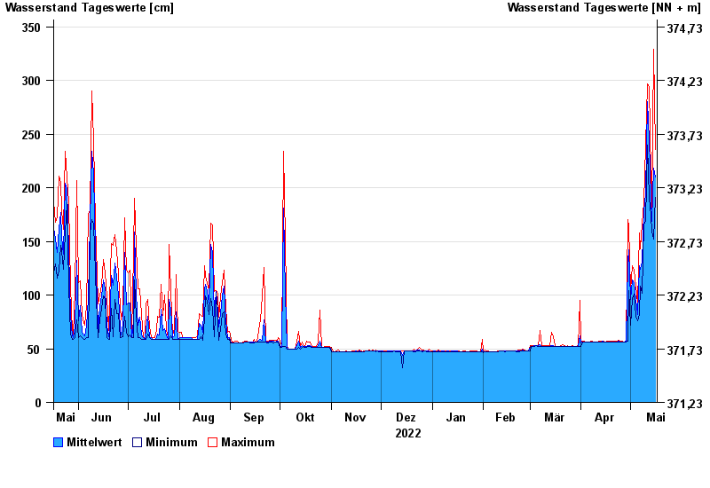
- Mühldorf >
- Chart of year

Chart of year Mühldorf / Inn
Waterlevel from 17.05.2022 to 16.05.2023
- 24.08.2005 Wasserstand: 799 cm
- 07.08.1985 Wasserstand: 766 cm
- 03.06.2013 Wasserstand: 708 cm
- 20.07.1981 Wasserstand: 677 cm
- 22.05.1999 Wasserstand: 662 cm
| Date | Mean value [cm] | Maximum [cm] | Minimum [cm] |
|---|---|---|---|
| 16.05.2023 | 210 | 236 | 191 |
| 15.05.2023 | 218 | 329 | 152 |
| 14.05.2023 | 169 | 179 | 159 |
| 13.05.2023 | 190 | 213 | 174 |
| 12.05.2023 | 245 | 294 | 190 |
| 11.05.2023 | 280 | 297 | 240 |
| 10.05.2023 | 194 | 240 | 169 |
© Bayerisches Landesamt für Umwelt 2024