
- Start >
- Rivers >
- Waterlevel >
- Inn >
- Mühldorf >
- Chart of year

Chart of year Mühldorf / Inn
Waterlevel from 17.05.2021 to 16.05.2022
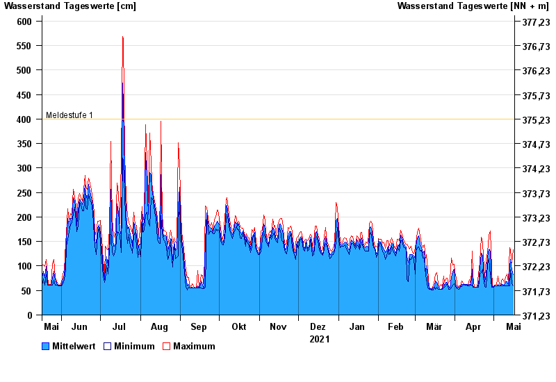
- Meldestufe 1 400 cm
- Hochwassergefahrenfläche HQ100 800 cm
| Date | Mean value [cm] | Maximum [cm] | Minimum [cm] |
|---|---|---|---|
| 16.05.2022 | 82 | 133 | 60 |
| 15.05.2022 | 92 | 106 | 64 |
| 14.05.2022 | 114 | 132 | 92 |
| 13.05.2022 | 98 | 137 | 60 |
| 12.05.2022 | 61 | 67 | 60 |
| 11.05.2022 | 68 | 83 | 60 |
| 10.05.2022 | 68 | 77 | 60 |
© Bayerisches Landesamt für Umwelt 2024