
- Start >
- Rivers >
- Waterlevel >
- Inn >
- Linden >
- Chart of month

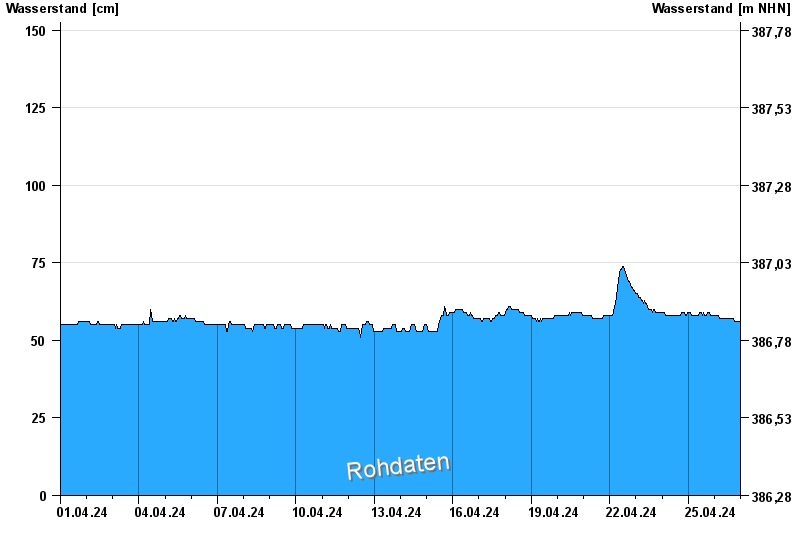
Chart of month Linden / Rott
Waterlevel from 01.04.2024 to 26.04.2024
- 02.03.1987 Wasserstand: 359 cm
- 02.08.1991 Wasserstand: 358 cm
- 03.06.2013 Wasserstand: 354 cm
- 20.02.1999 Wasserstand: 341 cm
- 13.01.2011 Wasserstand: 338 cm
| Date | Waterlevel [cm] |
|---|---|
| 26.04.2024 11:15 | 57 |
| 26.04.2024 11:00 | 57 |
| 26.04.2024 10:45 | 57 |
| 26.04.2024 10:30 | 57 |
| 26.04.2024 10:15 | 57 |
| 26.04.2024 10:00 | 57 |
| 26.04.2024 09:45 | 57 |
© Bayerisches Landesamt für Umwelt 2024