
- Start >
- Rivers >
- Waterlevel >
- Inn >
- Ilsank >
- Chart of month

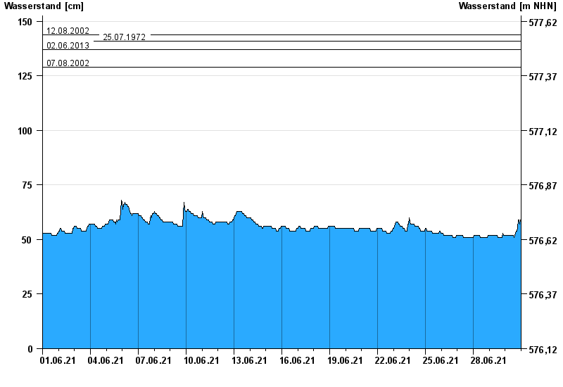
Chart of month Ilsank / Ramsauer Ache
Waterlevel from 01.06.2021 to 30.06.2021
- 17.07.2021 Wasserstand: 154 cm
- 12.08.2002 Wasserstand: 144 cm
- 25.07.1972 Wasserstand: 141 cm
- 02.06.2013 Wasserstand: 137 cm
- 07.08.2002 Wasserstand: 129 cm
| Date | Waterlevel [cm] |
|---|---|
| 01.07.2021 00:45 | 59 |
| 01.07.2021 00:30 | 59 |
| 01.07.2021 00:15 | 59 |
| 01.07.2021 00:00 | 59 |
| 30.06.2021 23:45 | 59 |
| 30.06.2021 23:30 | 59 |
| 30.06.2021 23:15 | 59 |
© Bayerisches Landesamt für Umwelt 2024