
- Start >
- Rivers >
- Waterlevel >
- Inn >
- Gaißach >
- Chart of month

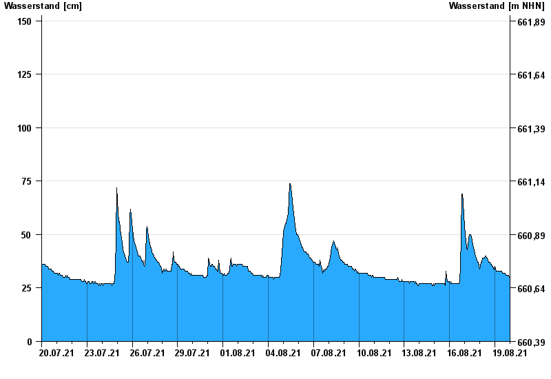
Chart of month Gaißach / Große Gaißach
Waterlevel from 20.07.2021 to 19.08.2021
- 23.07.1966 Wasserstand: 245 cm
- 21.05.1999 Wasserstand: 178 cm
- 12.08.2002 Wasserstand: 177 cm
- 10.08.1983 Wasserstand: 177 cm
- 23.08.2005 Wasserstand: 172 cm
| Date | Waterlevel [cm] |
|---|---|
| 20.08.2021 00:45 | 30 |
| 20.08.2021 00:30 | 30 |
| 20.08.2021 00:15 | 31 |
| 20.08.2021 00:00 | 30 |
| 19.08.2021 23:45 | 30 |
| 19.08.2021 23:30 | 31 |
| 19.08.2021 23:15 | 30 |
© Bayerisches Landesamt für Umwelt 2024