
- Start >
- Rivers >
- Waterlevel >
- Inn >
- Feldolling >
- Chart of year

Chart of year Feldolling / Mangfall
Waterlevel from 28.04.2024 to 27.04.2025
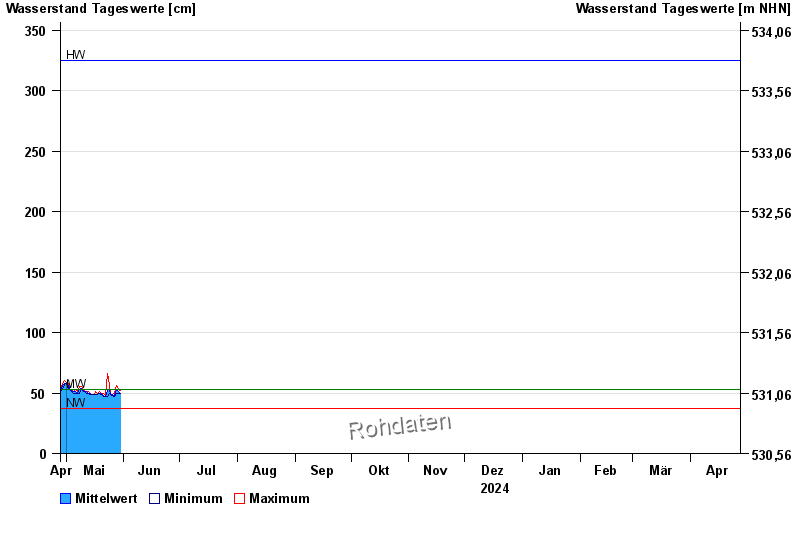
| Date | Mean value [cm] | Maximum [cm] | Minimum [cm] |
|---|---|---|---|
| 11.06.2024 | 79 | 84 | 75 |
| 10.06.2024 | 76 | 95 | 48 |
| 09.06.2024 | 79 | 84 | 77 |
| 08.06.2024 | 83 | 90 | 77 |
| 07.06.2024 | 97 | 104 | 91 |
| 06.06.2024 | 108 | 115 | 102 |
| 05.06.2024 | 125 | 136 | 115 |
© Bayerisches Landesamt für Umwelt 2024