
- Start >
- Rivers >
- Waterlevel >
- Inn >
- Erb >
- Chart of year

Chart of year Erb / Leitzach
Waterlevel from 26.01.2019 to 25.01.2020
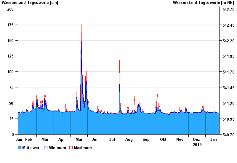
- Hochwassergefahrenfläche HQ100 240 cm
| Date | Mean value [cm] | Maximum [cm] | Minimum [cm] |
|---|---|---|---|
| 25.01.2020 | 34 | 34 | 34 |
| 24.01.2020 | 34 | 34 | 34 |
| 23.01.2020 | 34 | 34 | 34 |
| 22.01.2020 | 34 | 35 | 34 |
| 21.01.2020 | 35 | 36 | 34 |
| 20.01.2020 | 35 | 36 | 35 |
| 19.01.2020 | 36 | 36 | 35 |
© Bayerisches Landesamt für Umwelt 2024