
- Start >
- Rivers >
- Waterlevel >
- Inn >
- Dickertsmühle >
- Chart of month

Chart of month Dickertsmühle / Mühlbach
Waterlevel from 01.04.2024 to 28.04.2024
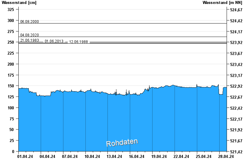
- 06.08.2000 Wasserstand: 293 cm
- 04.08.2020 Wasserstand: 262 cm
- 21.06.1983 Wasserstand: 250 cm
- 01.06.2013 Wasserstand: 248 cm
- 12.06.1988 Wasserstand: 247 cm
| Date | Waterlevel [cm] |
|---|---|
| 28.04.2024 16:15 | 146 |
| 28.04.2024 16:00 | 146 |
| 28.04.2024 15:45 | 146 |
| 28.04.2024 15:30 | 146 |
| 28.04.2024 15:15 | 146 |
| 28.04.2024 15:00 | 146 |
| 28.04.2024 14:45 | 146 |
© Bayerisches Landesamt für Umwelt 2024