
- Start >
- Rivers >
- Waterlevel >
- Inn >
- Brodhausen >
- Chart of month

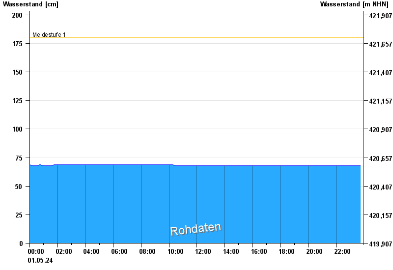
Chart of month Brodhausen / Sur
Waterlevel from 01.05.2024 to 01.05.2024
note
Zeitweise Beeinflussung der Daten durch Surspeichersteuerung möglich.
- Meldestufe 1 180 cm
| Date | Waterlevel [cm] |
|---|---|
| 01.05.2024 14:45 | 68 |
| 01.05.2024 14:30 | 68 |
| 01.05.2024 14:15 | 68 |
| 01.05.2024 14:00 | 68 |
| 01.05.2024 13:45 | 68 |
| 01.05.2024 13:30 | 68 |
| 01.05.2024 13:15 | 68 |
© Bayerisches Landesamt für Umwelt 2024