
- Start >
- Rivers >
- Waterlevel >
- Inn >
- Aßling >
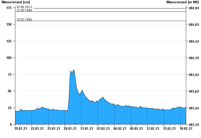
- Chart of month

Chart of month Aßling / Attel
Waterlevel from 19.01.2021 to 18.02.2021
- 02.08.1991 Wasserstand: 188 cm
- 04.08.2020 Wasserstand: 183 cm
- 02.06.2013 Wasserstand: 174 cm
- 21.05.1999 Wasserstand: 169 cm
- 15.02.1990 Wasserstand: 155 cm
| Date | Waterlevel [cm] |
|---|---|
| 18.02.2021 23:45 | 25 |
| 18.02.2021 23:30 | 25 |
| 18.02.2021 23:15 | 25 |
| 18.02.2021 23:00 | 25 |
| 18.02.2021 22:45 | 25 |
| 18.02.2021 22:30 | 25 |
| 18.02.2021 22:15 | 25 |
© Bayerisches Landesamt für Umwelt 2024