
- Start >
- Rivers >
- Waterlevel >
- Iller - Lech - Bodensee >
- Waldstetten >
- Chart of year

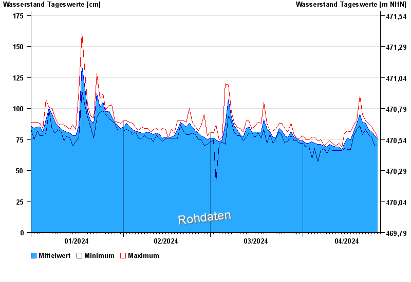
Chart of year Waldstetten / Günz
Waterlevel from 01.01.2024 to 26.04.2024
- 12.08.2002 Wasserstand: 279 cm
- 11.06.2013 Wasserstand: 270 cm
- 19.06.1991 Wasserstand: 265 cm
- 22.09.2000 Wasserstand: 256 cm
- 30.05.2007 Wasserstand: 255 cm
| Date | Mean value [cm] | Maximum [cm] | Minimum [cm] |
|---|---|---|---|
| 26.04.2024 | 76 | 77 | 70 |
| 25.04.2024 | 78 | 81 | 70 |
| 24.04.2024 | 81 | 85 | 77 |
| 23.04.2024 | 83 | 88 | 79 |
| 22.04.2024 | 88 | 90 | 83 |
| 21.04.2024 | 89 | 95 | 79 |
| 20.04.2024 | 95 | 110 | 86 |
© Bayerisches Landesamt für Umwelt 2024