
- Start >
- Rivers >
- Waterlevel >
- Iller - Lech - Bodensee >
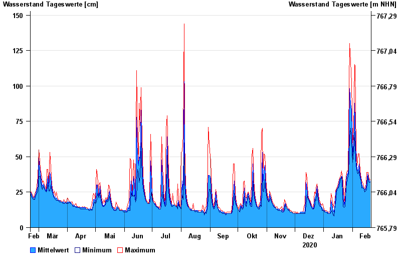
- Unterthingau >
- Chart of year

Chart of year Unterthingau / Kirnach
Waterlevel from 21.02.2020 to 20.02.2021
- 30.06.2011 Wasserstand: 223 cm
- 06.08.2010 Wasserstand: 201 cm
- 12.09.2013 Wasserstand: 191 cm
- 03.06.2010 Wasserstand: 190 cm
- 22.04.2008 Wasserstand: 182 cm
| Date | Mean value [cm] | Maximum [cm] | Minimum [cm] |
|---|---|---|---|
| 20.02.2021 | 33 | 34 | 32 |
| 19.02.2021 | 33 | 34 | 32 |
| 18.02.2021 | 36 | 39 | 33 |
| 17.02.2021 | 38 | 39 | 36 |
| 16.02.2021 | 32 | 39 | 27 |
| 15.02.2021 | 27 | 27 | 26 |
| 14.02.2021 | 27 | 28 | 25 |
© Bayerisches Landesamt für Umwelt 2024