
- Start >
- Rivers >
- Waterlevel >
- Iller - Lech - Bodensee >
- Unterthingau >
- Current values

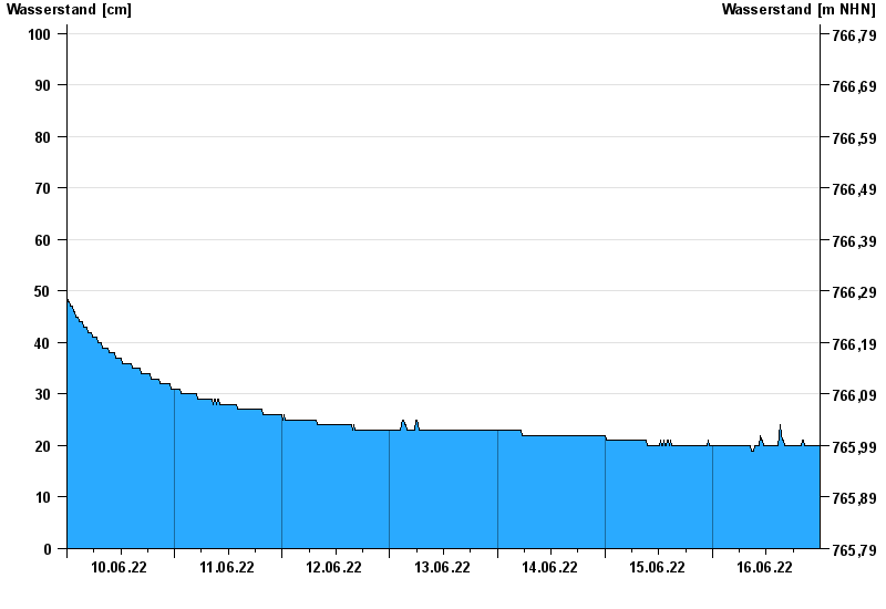
Current values Unterthingau / Kirnach
Waterlevel from 10.06.2022 to 16.06.2022
- 30.06.2011 Wasserstand: 223 cm
- 06.08.2010 Wasserstand: 201 cm
- 12.09.2013 Wasserstand: 191 cm
- 03.06.2010 Wasserstand: 190 cm
- 22.04.2008 Wasserstand: 182 cm
| Date | Waterlevel [cm] |
|---|---|
| 17.06.2022 00:45 | 20 |
| 17.06.2022 00:30 | 20 |
| 17.06.2022 00:15 | 20 |
| 17.06.2022 00:00 | 20 |
| 16.06.2022 23:45 | 20 |
| 16.06.2022 23:30 | 20 |
| 16.06.2022 23:15 | 20 |
© Bayerisches Landesamt für Umwelt 2024