
- Start >
- Rivers >
- Waterlevel >
- Iller - Lech - Bodensee >
- Türkheim >
- Chart of year

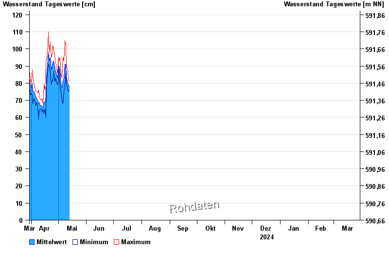
Chart of year Türkheim / Wertach
Waterlevel from 30.03.2024 to 29.03.2025
note
Beeinflussung durch Kraftwerksbetrieb
- 360 cm: Türkheim: Ausuferungen oberhalb Türkheim links.
| Date | Mean value [cm] | Maximum [cm] | Minimum [cm] |
|---|---|---|---|
| 28.04.2024 | 88 | 92 | 84 |
| 27.04.2024 | 89 | 96 | 81 |
| 26.04.2024 | 93 | 99 | 87 |
| 25.04.2024 | 92 | 102 | 81 |
| 24.04.2024 | 90 | 97 | 82 |
| 23.04.2024 | 88 | 95 | 79 |
| 22.04.2024 | 95 | 104 | 86 |
© Bayerisches Landesamt für Umwelt 2024