
- Start >
- Rivers >
- Waterlevel >
- Iller - Lech - Bodensee >
- Trauchgau >
- Chart of month

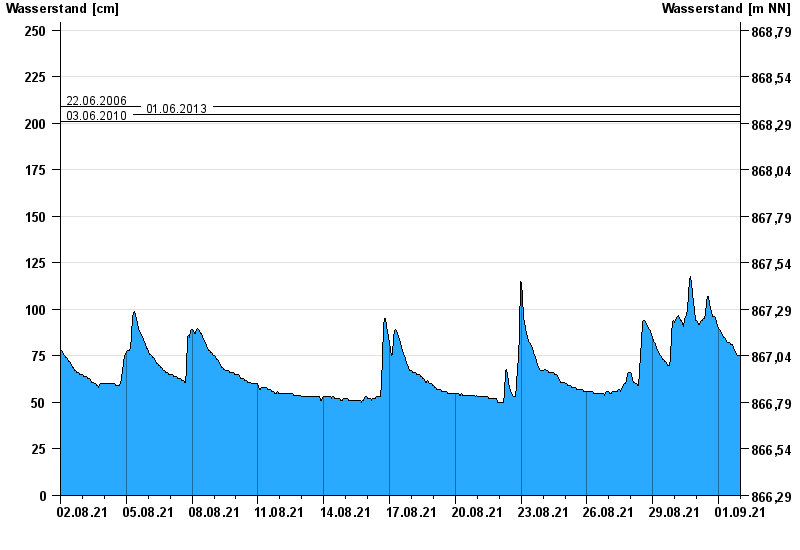
Chart of month Trauchgau / Halblech
Waterlevel from 02.08.2021 to 01.09.2021
- 23.08.2005 Wasserstand: 273 cm
- 22.05.1999 Wasserstand: 258 cm
- 22.06.2006 Wasserstand: 209 cm
- 01.06.2013 Wasserstand: 205 cm
- 03.06.2010 Wasserstand: 201 cm
| Date | Waterlevel [cm] |
|---|---|
| 02.09.2021 00:45 | 74 |
| 02.09.2021 00:30 | 74 |
| 02.09.2021 00:15 | 74 |
| 02.09.2021 00:00 | 74 |
| 01.09.2021 23:45 | 74 |
| 01.09.2021 23:30 | 75 |
| 01.09.2021 23:15 | 75 |
© Bayerisches Landesamt für Umwelt 2024