
- Start >
- Rivers >
- Waterlevel >
- Iller - Lech - Bodensee >
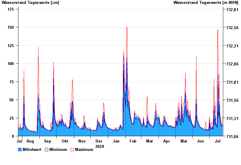
- Thalkirchdorf >
- Chart of year

Chart of year Thalkirchdorf / Konstanzer Ach
Waterlevel from 25.07.2020 to 24.07.2021
- 23.08.2005 Wasserstand: 212 cm
- 22.05.1999 Wasserstand: 208 cm
- 12.08.2002 Wasserstand: 188 cm
- 15.02.1990 Wasserstand: 185 cm
- 02.06.1976 Wasserstand: 179 cm
| Date | Mean value [cm] | Maximum [cm] | Minimum [cm] |
|---|---|---|---|
| 24.07.2021 | 16 | 27 | 13 |
| 23.07.2021 | 14 | 15 | 13 |
| 22.07.2021 | 15 | 16 | 14 |
| 21.07.2021 | 17 | 19 | 16 |
| 20.07.2021 | 21 | 24 | 19 |
| 19.07.2021 | 29 | 35 | 24 |
| 18.07.2021 | 48 | 86 | 35 |
© Bayerisches Landesamt für Umwelt 2024