
- Start >
- Rivers >
- Waterlevel >
- Iller - Lech - Bodensee >
- Thalhofen >
- Chart of month

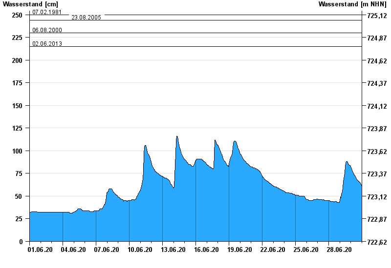
Chart of month Thalhofen / Wertach
Waterlevel from 01.06.2020 to 30.06.2020
- 22.05.1999 Wasserstand: 290 cm
- 07.02.1981 Wasserstand: 250 cm
- 23.08.2005 Wasserstand: 244 cm
- 06.08.2000 Wasserstand: 230 cm
- 02.06.2013 Wasserstand: 215 cm
| Date | Waterlevel [cm] |
|---|---|
| 01.07.2020 00:45 | 61 |
| 01.07.2020 00:30 | 61 |
| 01.07.2020 00:15 | 61 |
| 01.07.2020 00:00 | 62 |
| 30.06.2020 23:45 | 62 |
| 30.06.2020 23:30 | 62 |
| 30.06.2020 23:15 | 62 |
© Bayerisches Landesamt für Umwelt 2024