
- Start >
- Rivers >
- Waterlevel >
- Iller - Lech - Bodensee >
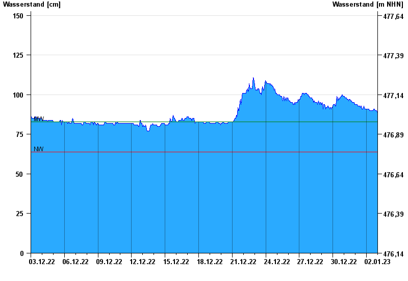
- Roth >
- Chart of month

Chart of month Roth / Roth
Waterlevel from 03.12.2022 to 02.01.2023
| Date | Waterlevel [cm] |
|---|---|
| 02.01.2023 23:45 | 89 |
| 02.01.2023 23:30 | 89 |
| 02.01.2023 23:15 | 89 |
| 02.01.2023 23:00 | 89 |
| 02.01.2023 22:45 | 89 |
| 02.01.2023 22:30 | 89 |
| 02.01.2023 22:15 | 90 |
© Bayerisches Landesamt für Umwelt 2024