
- Start >
- Rivers >
- Waterlevel >
- Iller - Lech - Bodensee >
- Rosenheim o.d. Mangfallmündung >
- Chart of year

Chart of year Rosenheim o.d. Mangfallmündung / Inn
Waterlevel from 04.08.2021 to 03.08.2022
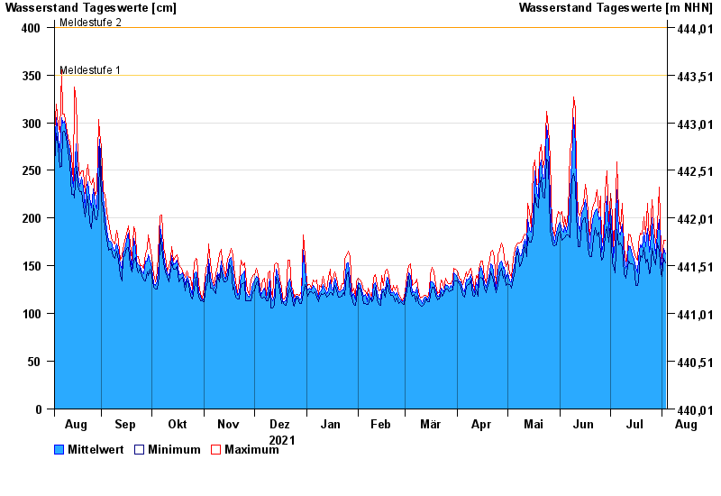
- Meldestufe 1 350 cm
- Meldestufe 2 400 cm
- Meldestufe 3 500 cm
- Hochwassergefahrenfläche HQ100 570 cm
| Date | Mean value [cm] | Maximum [cm] | Minimum [cm] |
|---|---|---|---|
| 03.08.2022 | 163 | 177 | 153 |
| 02.08.2022 | 168 | 177 | 158 |
| 01.08.2022 | 148 | 158 | 139 |
| 31.07.2022 | 153 | 165 | 141 |
| 30.07.2022 | 198 | 232 | 165 |
| 29.07.2022 | 183 | 193 | 174 |
| 28.07.2022 | 163 | 174 | 151 |
© Bayerisches Landesamt für Umwelt 2024