
- Start >
- Rivers >
- Waterlevel >
- Iller - Lech - Bodensee >
- Rosenheim o.d. Mangfallmündung >
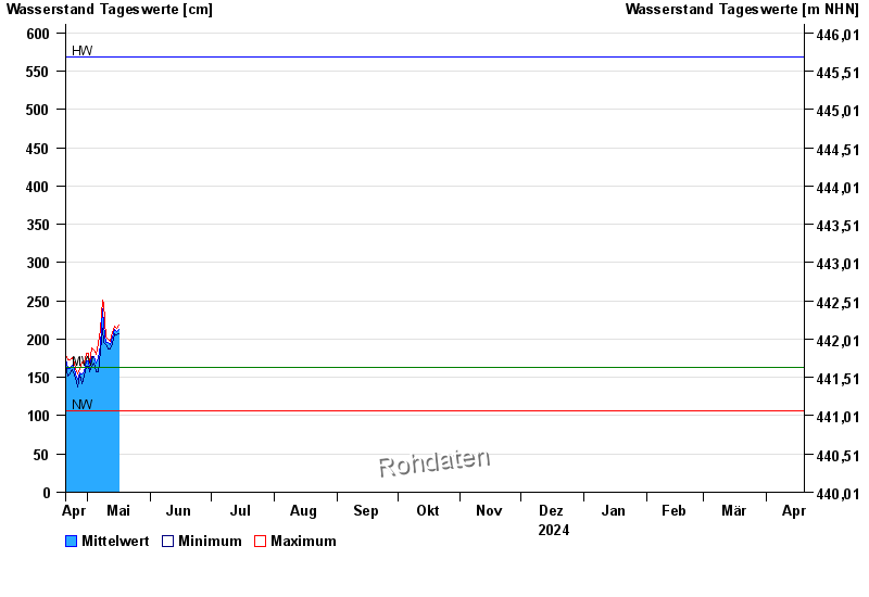
- Chart of year

Chart of year Rosenheim o.d. Mangfallmündung / Inn
Waterlevel from 20.04.2024 to 19.04.2025
| Date | Mean value [cm] | Maximum [cm] | Minimum [cm] |
|---|---|---|---|
| 17.05.2024 | 238 | 258 | 227 |
| 16.05.2024 | 222 | 233 | 207 |
| 15.05.2024 | 210 | 214 | 206 |
| 14.05.2024 | 212 | 217 | 207 |
| 13.05.2024 | 203 | 208 | 194 |
| 12.05.2024 | 193 | 197 | 187 |
| 11.05.2024 | 196 | 200 | 187 |
© Bayerisches Landesamt für Umwelt 2024