
- Start >
- Rivers >
- Waterlevel >
- Iller - Lech - Bodensee >
- Remshart >
- Chart of year

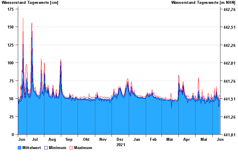
Chart of year Remshart / Kammel
Waterlevel from 15.06.2021 to 14.06.2022
- 22.09.2000 Wasserstand: 234 cm
- 12.08.2002 Wasserstand: 228 cm
- 11.06.2013 Wasserstand: 223 cm
- 19.06.1991 Wasserstand: 220 cm
- 14.04.1994 Wasserstand: 214 cm
| Date | Mean value [cm] | Maximum [cm] | Minimum [cm] |
|---|---|---|---|
| 14.06.2022 | 50 | 53 | 48 |
| 13.06.2022 | 50 | 55 | 39 |
| 12.06.2022 | 48 | 50 | 39 |
| 11.06.2022 | 49 | 51 | 48 |
| 10.06.2022 | 52 | 54 | 50 |
| 09.06.2022 | 53 | 56 | 49 |
| 08.06.2022 | 60 | 67 | 55 |
© Bayerisches Landesamt für Umwelt 2024