
- Start >
- Rivers >
- Waterlevel >
- Iller - Lech - Bodensee >
- Remshart >
- Current values

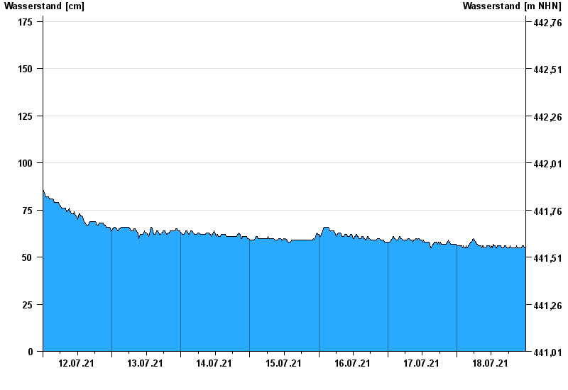
Current values Remshart / Kammel
Waterlevel from 12.07.2021 to 18.07.2021
- 22.09.2000 Wasserstand: 234 cm
- 12.08.2002 Wasserstand: 228 cm
- 11.06.2013 Wasserstand: 223 cm
- 19.06.1991 Wasserstand: 220 cm
- 14.04.1994 Wasserstand: 214 cm
| Date | Waterlevel [cm] |
|---|---|
| 19.07.2021 00:45 | 55 |
| 19.07.2021 00:30 | 55 |
| 19.07.2021 00:15 | 55 |
| 19.07.2021 00:00 | 55 |
| 18.07.2021 23:45 | 55 |
| 18.07.2021 23:30 | 55 |
| 18.07.2021 23:15 | 56 |
© Bayerisches Landesamt für Umwelt 2024