
- Start >
- Rivers >
- Waterlevel >
- Iller - Lech - Bodensee >
- Pfronten Ried >
- Chart of year

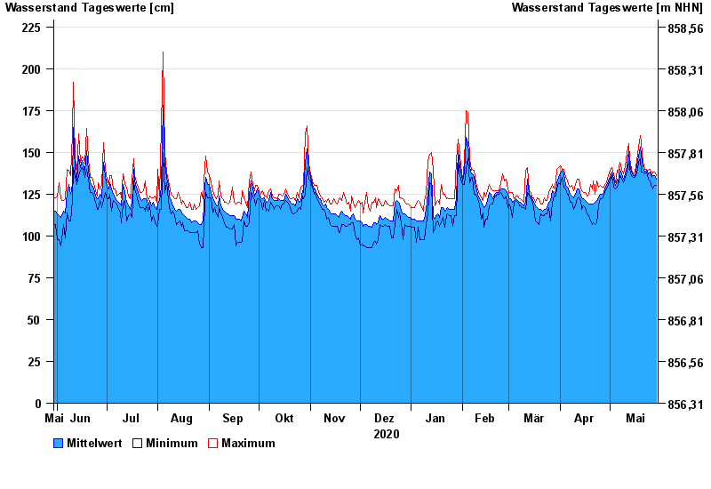
Chart of year Pfronten Ried / Vils
Waterlevel from 30.05.2020 to 29.05.2021
- 22.05.1999 Wasserstand: 330 cm
- 22.08.2005 Wasserstand: 296 cm
- 06.08.2000 Wasserstand: 292 cm
- 12.08.2002 Wasserstand: 284 cm
- 13.05.1999 Wasserstand: 278 cm
| Date | Mean value [cm] | Maximum [cm] | Minimum [cm] |
|---|---|---|---|
| 29.05.2021 | 134 | 136 | 130 |
| 28.05.2021 | 136 | 138 | 130 |
| 27.05.2021 | 136 | 138 | 128 |
| 26.05.2021 | 135 | 136 | 129 |
| 25.05.2021 | 138 | 140 | 133 |
| 24.05.2021 | 137 | 139 | 134 |
| 23.05.2021 | 139 | 140 | 138 |
© Bayerisches Landesamt für Umwelt 2024