
- Start >
- Rivers >
- Waterlevel >
- Iller - Lech - Bodensee >
- Lauben >
- Chart of year

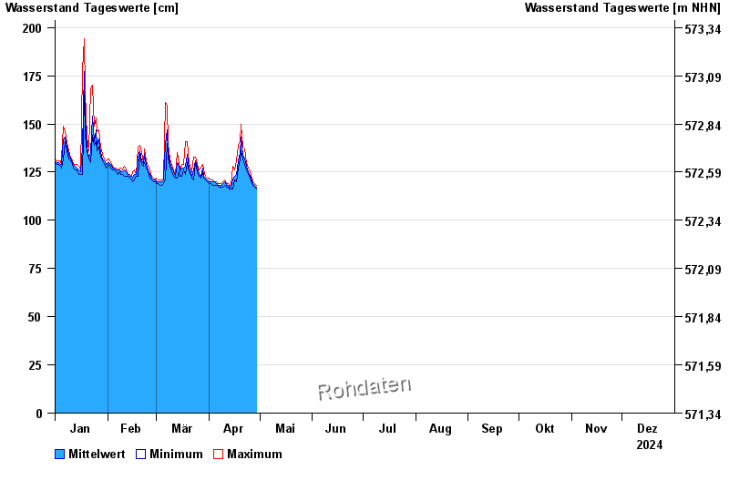
Chart of year Lauben / Günz
Waterlevel from 01.01.2024 to 31.12.2024
- 236 cm: Babenhausen: Ausuferungen am Mühlkanal (Fabrikstraße)
| Date | Mean value [cm] | Maximum [cm] | Minimum [cm] |
|---|---|---|---|
| 04.06.2024 | 196 | 199 | 192 |
| 03.06.2024 | 208 | 216 | 200 |
| 02.06.2024 | 227 | 250 | 204 |
| 01.06.2024 | 258 | 264 | 250 |
| 31.05.2024 | 189 | 255 | 147 |
| 30.05.2024 | 132 | 152 | 121 |
| 29.05.2024 | 124 | 129 | 121 |
© Bayerisches Landesamt für Umwelt 2024