
- Start >
- Rivers >
- Waterlevel >
- Iller - Lech - Bodensee >
- Langerringen >
- Chart of year

Chart of year Langerringen / Singold
Waterlevel from 01.01.2024 to 31.12.2024
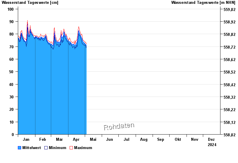
| Date | Mean value [cm] | Maximum [cm] | Minimum [cm] |
|---|---|---|---|
| 03.06.2024 | 106 | 111 | 103 |
| 02.06.2024 | 121 | 132 | 111 |
| 01.06.2024 | 127 | 136 | 114 |
| 31.05.2024 | 90 | 114 | 75 |
| 30.05.2024 | 75 | 78 | 71 |
| 29.05.2024 | 73 | 75 | 71 |
| 28.05.2024 | 74 | 76 | 72 |
© Bayerisches Landesamt für Umwelt 2024