
- Start >
- Rivers >
- Waterlevel >
- Iller - Lech - Bodensee >
- Kempten >
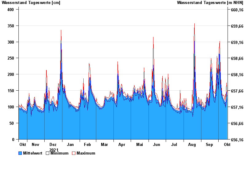
- Chart of year

Chart of year Kempten / Iller
Waterlevel from 17.10.2021 to 16.10.2022
- 23.08.2005 Wasserstand: 646 cm
- 22.05.1999 Wasserstand: 631 cm
- 12.08.2002 Wasserstand: 555 cm
- 10.08.1970 Wasserstand: 542 cm
- 02.06.2013 Wasserstand: 535 cm
| Date | Mean value [cm] | Maximum [cm] | Minimum [cm] |
|---|---|---|---|
| 16.10.2022 | 133 | 145 | 125 |
| 15.10.2022 | 146 | 174 | 116 |
| 14.10.2022 | 115 | 130 | 110 |
| 13.10.2022 | 112 | 139 | 98 |
| 12.10.2022 | 115 | 119 | 112 |
| 11.10.2022 | 118 | 131 | 109 |
| 10.10.2022 | 121 | 137 | 113 |
© Bayerisches Landesamt für Umwelt 2024