
- Start >
- Rivers >
- Waterlevel >
- Iller - Lech - Bodensee >
- Heroldingen >
- Chart of month

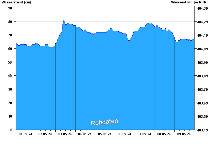
Chart of month Heroldingen / Wörnitz
Waterlevel from 01.05.2024 to 09.05.2024
- Hochwassergefahrenfläche HQ100 500 cm
- Hochwassergefahrenfläche HQhäufig 410 cm
| Date | Waterlevel [cm] |
|---|---|
| 09.05.2024 13:45 | 67 |
| 09.05.2024 13:30 | 67 |
| 09.05.2024 13:15 | 67 |
| 09.05.2024 13:00 | 67 |
| 09.05.2024 12:45 | 67 |
| 09.05.2024 12:30 | 67 |
| 09.05.2024 12:15 | 67 |
© Bayerisches Landesamt für Umwelt 2024