
- Start >
- Rivers >
- Waterlevel >
- Iller - Lech - Bodensee >
- Görisried >
- Current values

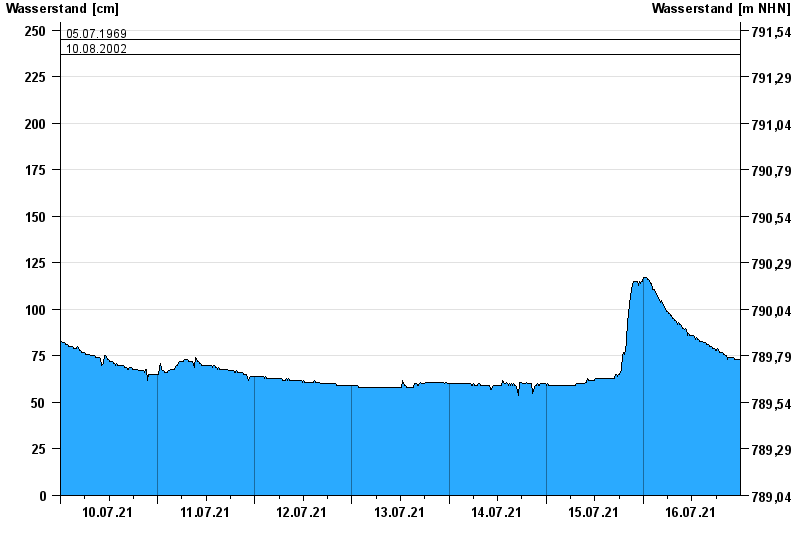
Current values Görisried / Waldbach
Waterlevel from 10.07.2021 to 16.07.2021
- 20.07.2007 Wasserstand: 327 cm
- 10.08.1970 Wasserstand: 289 cm
- 15.07.2002 Wasserstand: 271 cm
- 05.07.1969 Wasserstand: 245 cm
- 10.08.2002 Wasserstand: 237 cm
| Date | Waterlevel [cm] |
|---|---|
| 17.07.2021 00:45 | 72 |
| 17.07.2021 00:30 | 72 |
| 17.07.2021 00:15 | 72 |
| 17.07.2021 00:00 | 72 |
| 16.07.2021 23:45 | 73 |
| 16.07.2021 23:30 | 73 |
| 16.07.2021 23:15 | 73 |
© Bayerisches Landesamt für Umwelt 2024