
- Start >
- Rivers >
- Waterlevel >
- Iller - Lech - Bodensee >
- Eschach >
- Chart of year

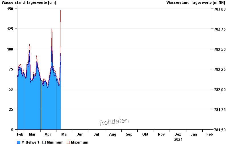
Chart of year Eschach / Füssener Achen
Waterlevel from 17.02.2024 to 16.02.2025
 Für diesen Pegel sind keine Hochwassermarken hinterlegt.
| Date | Mean value [cm] | Maximum [cm] | Minimum [cm] |
|---|---|---|---|
| 27.04.2024 | 69 | 73 | 66 |
| 26.04.2024 | 73 | 77 | 67 |
| 25.04.2024 | 77 | 79 | 77 |
| 24.04.2024 | 75 | 77 | 74 |
| 23.04.2024 | 90 | 119 | 73 |
| 22.04.2024 | 103 | 125 | 79 |
| 21.04.2024 | 78 | 80 | 75 |
© Bayerisches Landesamt für Umwelt 2024