
- Start >
- Rivers >
- Waterlevel >
- Iller - Lech - Bodensee >
- Donauwörth >
- Chart of year

Chart of year Donauwörth / Donau
Waterlevel from 30.03.2024 to 29.03.2025
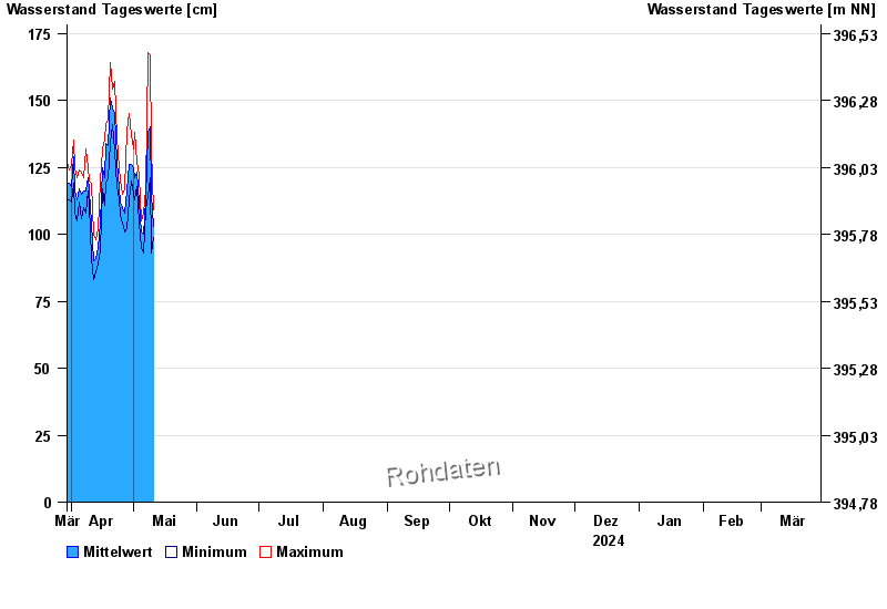
| Date | Mean value [cm] | Maximum [cm] | Minimum [cm] |
|---|---|---|---|
| 16.05.2024 | 93 | 96 | 91 |
| 15.05.2024 | 93 | 98 | 88 |
| 14.05.2024 | 98 | 114 | 89 |
| 13.05.2024 | 95 | 105 | 88 |
| 12.05.2024 | 98 | 107 | 87 |
| 11.05.2024 | 101 | 109 | 52 |
| 10.05.2024 | 115 | 132 | 93 |
© Bayerisches Landesamt für Umwelt 2024