
- Start >
- Rivers >
- Waterlevel >
- Iller - Lech - Bodensee >
- Donauwörth >
- Chart of year

Chart of year Donauwörth / Donau
Waterlevel from 01.01.2023 to 31.12.2023
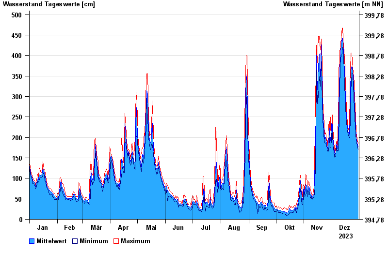
| Date | Mean value [cm] | Maximum [cm] | Minimum [cm] |
|---|---|---|---|
| 31.12.2023 | 177 | 185 | 170 |
| 30.12.2023 | 188 | 196 | 182 |
| 29.12.2023 | 200 | 213 | 190 |
| 28.12.2023 | 227 | 249 | 210 |
| 27.12.2023 | 273 | 297 | 247 |
| 26.12.2023 | 329 | 356 | 297 |
| 25.12.2023 | 362 | 367 | 355 |
© Bayerisches Landesamt für Umwelt 2024