
- Start >
- Rivers >
- Waterlevel >
- Iller - Lech - Bodensee >
- Donauwörth >
- Chart of year

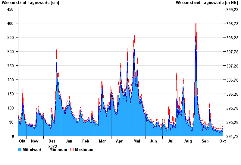
Chart of year Donauwörth / Donau
Waterlevel from 17.10.2022 to 16.10.2023
- 14.04.1994 Wasserstand: 577 cm
- 16.02.1990 Wasserstand: 553 cm
- 24.05.1999 Wasserstand: 552 cm
- 27.03.1988 Wasserstand: 544 cm
- 01.02.1982 Wasserstand: 543 cm
| Date | Mean value [cm] | Maximum [cm] | Minimum [cm] |
|---|---|---|---|
| 16.10.2023 | 27 | 34 | 16 |
| 15.10.2023 | 23 | 30 | 13 |
| 14.10.2023 | 17 | 26 | 8 |
| 13.10.2023 | 14 | 22 | 8 |
| 12.10.2023 | 19 | 27 | 12 |
| 11.10.2023 | 17 | 27 | 13 |
| 10.10.2023 | 20 | 30 | 13 |
© Bayerisches Landesamt für Umwelt 2024