
- Start >
- Rivers >
- Waterlevel >
- Iller - Lech - Bodensee >
- Biessenhofen >
- Chart of year

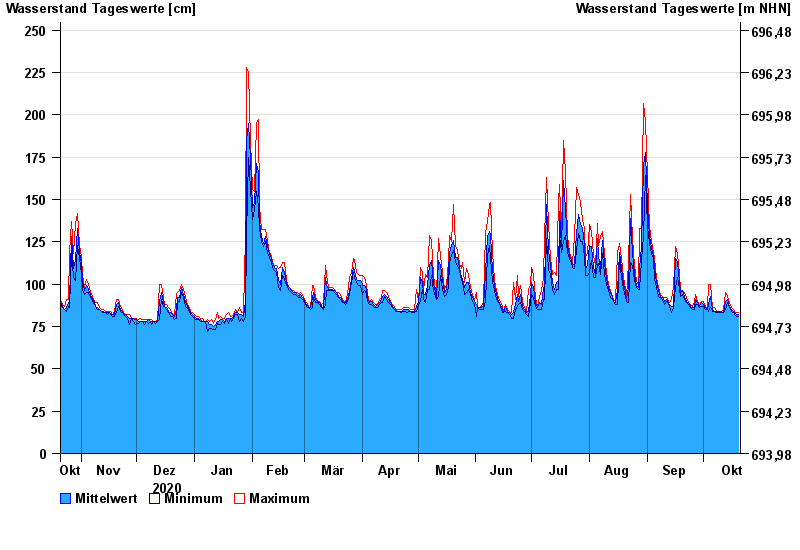
Chart of year Biessenhofen / Wertach
Waterlevel from 21.10.2020 to 20.10.2021
- 22.05.1999 Wasserstand: 356 cm
- 23.08.2005 Wasserstand: 343 cm
- 06.08.2000 Wasserstand: 330 cm
- 15.01.1968 Wasserstand: 328 cm
- 10.08.1970 Wasserstand: 327 cm
| Date | Mean value [cm] | Maximum [cm] | Minimum [cm] |
|---|---|---|---|
| 20.10.2021 | 82 | 83 | 81 |
| 19.10.2021 | 82 | 83 | 81 |
| 18.10.2021 | 83 | 84 | 82 |
| 17.10.2021 | 84 | 85 | 83 |
| 16.10.2021 | 85 | 86 | 84 |
| 15.10.2021 | 87 | 89 | 86 |
| 14.10.2021 | 91 | 93 | 89 |
© Bayerisches Landesamt für Umwelt 2024