
- Start >
- Rivers >
- Waterlevel >
- Iller - Lech - Bodensee >
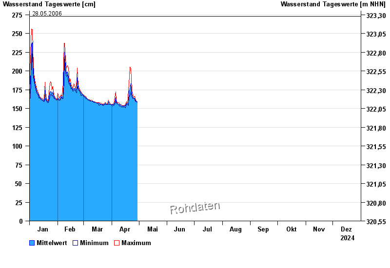
- Behringersmühle >
- Chart of year

Chart of year Behringersmühle / Wiesent
Waterlevel from 01.01.2024 to 31.12.2024
- 13.01.2011 Wasserstand: 290 cm
- 03.06.2013 Wasserstand: 279 cm
- 27.08.2010 Wasserstand: 278 cm
- 23.12.2012 Wasserstand: 276 cm
- 28.05.2006 Wasserstand: 273 cm
| Date | Mean value [cm] | Maximum [cm] | Minimum [cm] |
|---|---|---|---|
| 16.06.2024 | 155 | 156 | 154 |
| 15.06.2024 | 155 | 157 | 153 |
| 14.06.2024 | 154 | 154 | 153 |
| 13.06.2024 | 154 | 155 | 154 |
| 12.06.2024 | 155 | 155 | 155 |
| 11.06.2024 | 156 | 157 | 155 |
| 10.06.2024 | 157 | 158 | 156 |
© Bayerisches Landesamt für Umwelt 2024