
- Start >
- Rivers >
- Waterlevel >
- Oberer Main - Elbe >
- Wirsberg >
- Chart of year

Chart of year Wirsberg / Schorgast
Waterlevel from 01.01.2024 to 26.04.2024
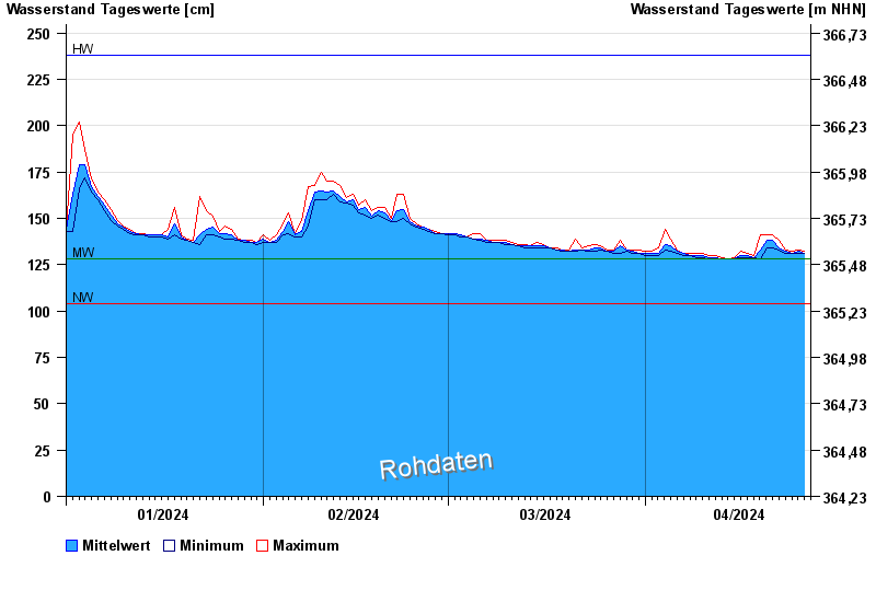
| Date | Mean value [cm] | Maximum [cm] | Minimum [cm] |
|---|---|---|---|
| 26.04.2024 | 132 | 132 | 131 |
| 25.04.2024 | 132 | 133 | 131 |
| 24.04.2024 | 131 | 132 | 131 |
| 23.04.2024 | 132 | 133 | 131 |
| 22.04.2024 | 134 | 138 | 133 |
| 21.04.2024 | 138 | 141 | 134 |
| 20.04.2024 | 138 | 141 | 134 |
© Bayerisches Landesamt für Umwelt 2024