
- Start >
- Rivers >
- Waterlevel >
- Oberer Main - Elbe >
- Wirsberg >
- Chart of month

Chart of month Wirsberg / Schorgast
Waterlevel from 18.01.2022 to 17.02.2022
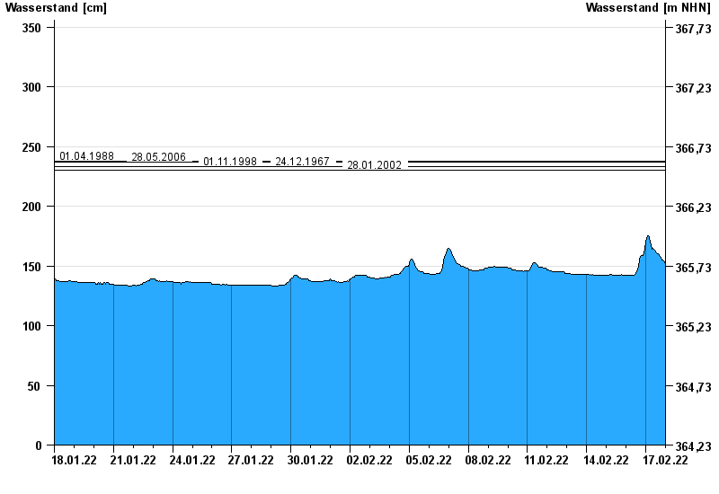
- 01.04.1988 Wasserstand: 238 cm
- 28.05.2006 Wasserstand: 237 cm
- 01.11.1998 Wasserstand: 233 cm
- 24.12.1967 Wasserstand: 233 cm
- 28.01.2002 Wasserstand: 230 cm
| Date | Waterlevel [cm] |
|---|---|
| 17.02.2022 23:45 | 152 |
| 17.02.2022 23:30 | 152 |
| 17.02.2022 23:15 | 152 |
| 17.02.2022 23:00 | 153 |
| 17.02.2022 22:45 | 153 |
| 17.02.2022 22:30 | 153 |
| 17.02.2022 22:15 | 153 |
© Bayerisches Landesamt für Umwelt 2024