
- Start >
- Rivers >
- Waterlevel >
- Oberer Main - Elbe >
- Wasserburg >
- Chart of year

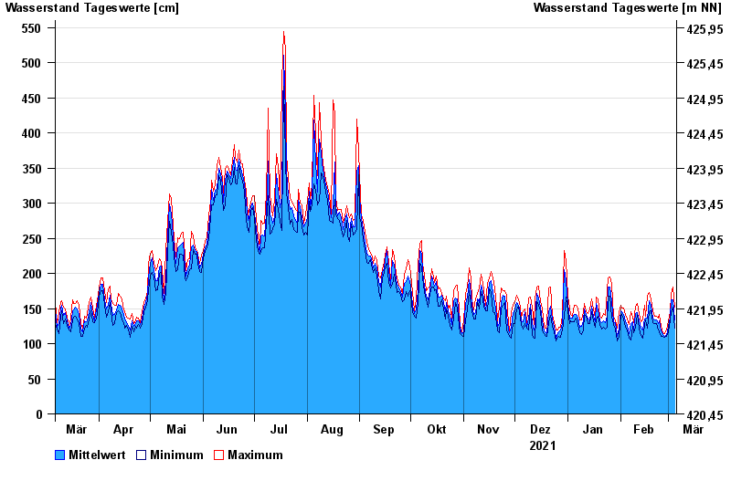
Chart of year Wasserburg / Inn
Waterlevel from 06.03.2021 to 05.03.2022
- 23.08.2005 Wasserstand: 719 cm
- 07.08.1985 Wasserstand: 670 cm
- 21.05.1999 Wasserstand: 638 cm
- 02.06.2013 Wasserstand: 630 cm
- 20.07.1981 Wasserstand: 615 cm
| Date | Mean value [cm] | Maximum [cm] | Minimum [cm] |
|---|---|---|---|
| 05.03.2022 | 134 | 152 | 122 |
| 04.03.2022 | 163 | 180 | 152 |
| 03.03.2022 | 163 | 170 | 145 |
| 02.03.2022 | 138 | 145 | 133 |
| 01.03.2022 | 125 | 133 | 117 |
| 28.02.2022 | 112 | 119 | 110 |
| 27.02.2022 | 111 | 114 | 109 |
© Bayerisches Landesamt für Umwelt 2024